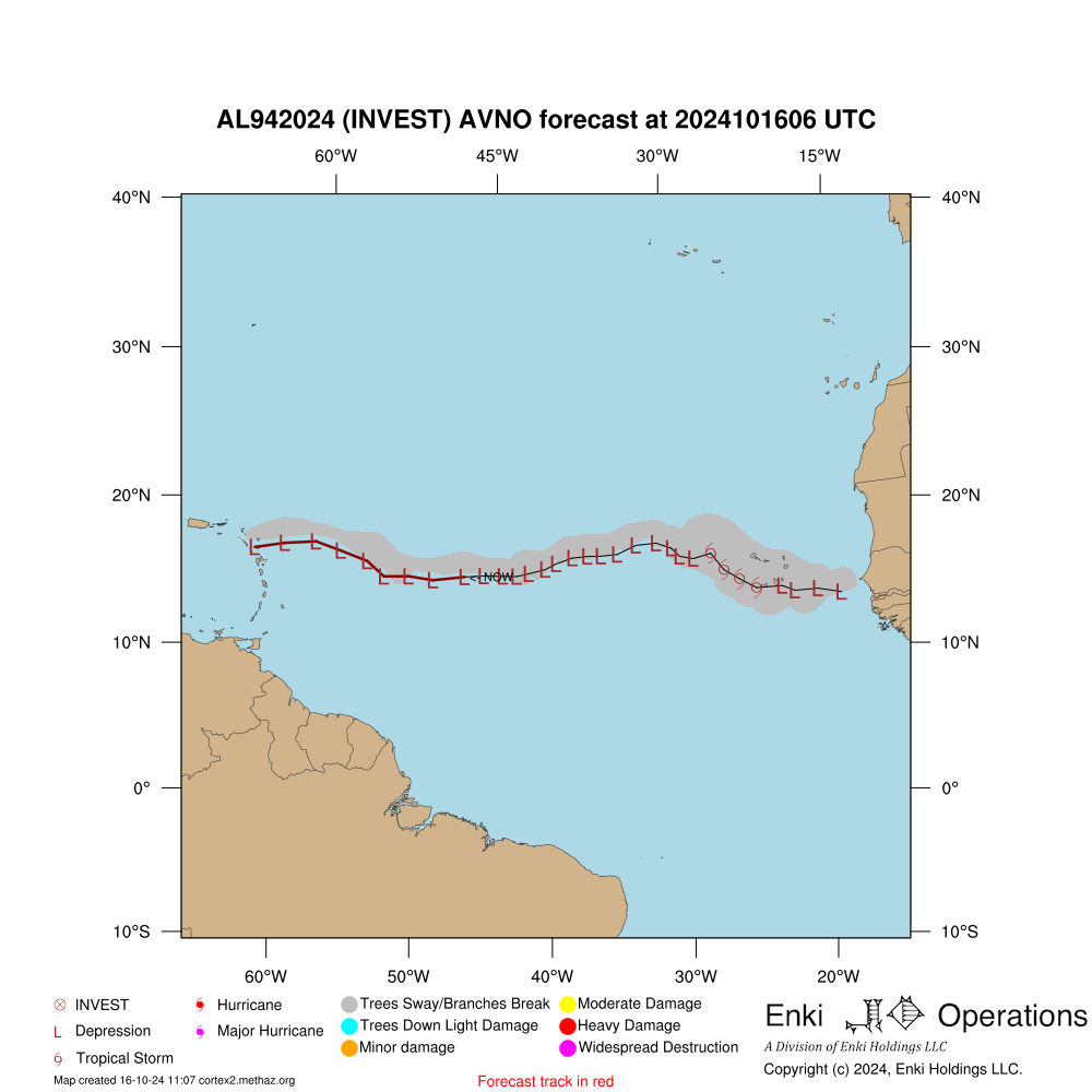
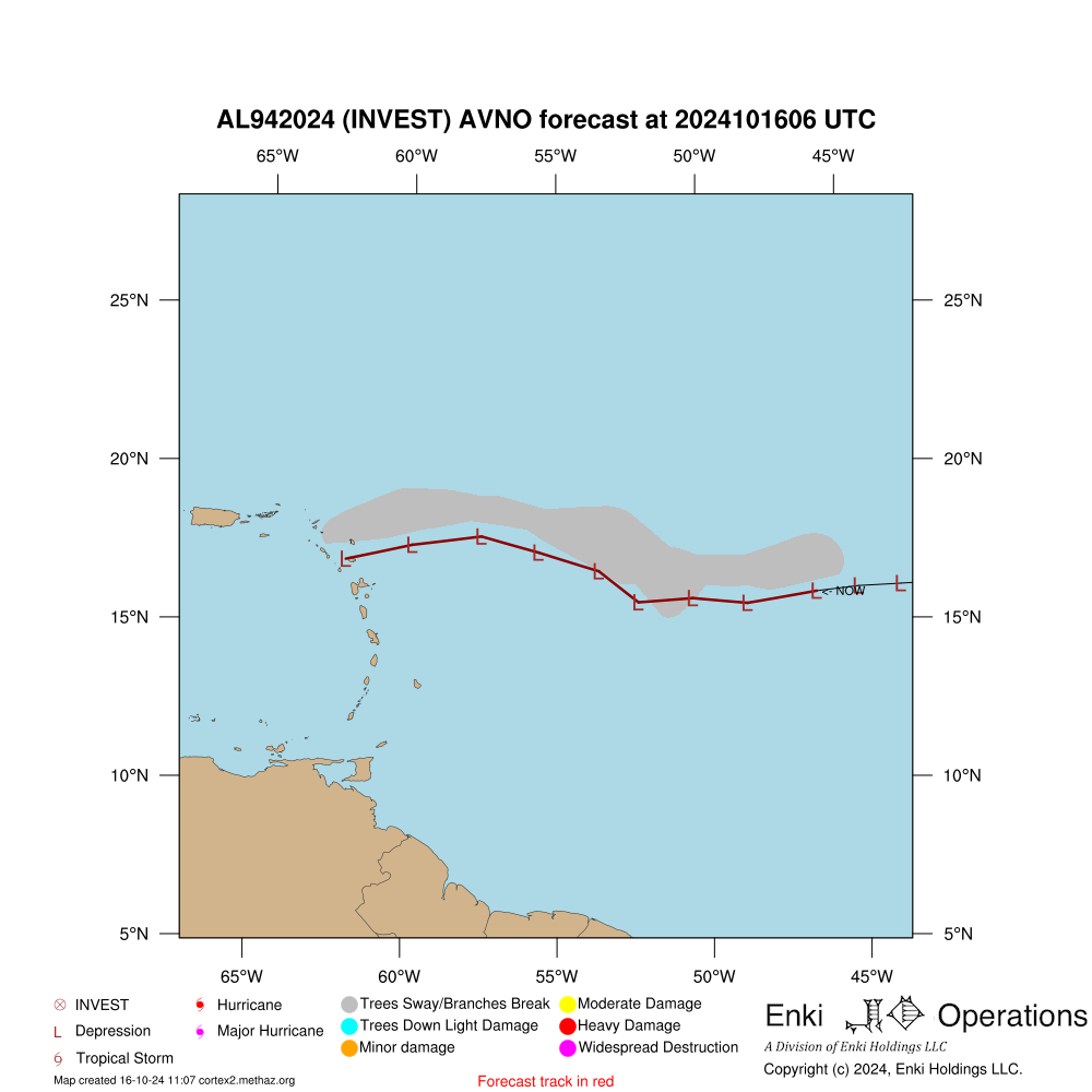
Official Forecast (or best model for invest) Overview
CAUTION!
This simulation is NOT based on the official forecast track! It is using the AVNO model.
More than likely this is because it is an invest area and does not have an official track yet.
JTWC Forecast Consistency Evaluation
Forecast
Index
Consistency
Objective Model Dispersion Evaluation
Forecast
Index
Consistency
Forecast consistency is based on how much difference there is between this forecast and a previous forecast.
If the variation between the current forecast and the forecast made 24 hours previously is less than half of the average error, consistency is Excellent.
Between half and the average, Good, between the average and 1.5 times the average Fair,
and if over 1.5 times the average historical error consistency isconsidered Poor.
Note that consistency is different from accuracy, but accuracy can only be determined in hindsight.
A consistent forecast is more likely to be accurate than one that is jumping around, but it could be consistently wrong!
National Level Economic Impact Forecast
name
totloss
type
loss
Total Forecast Impact:
National Level Population Impact Forecast
country_name
pop_tswind
pop_huwind
pop_surge
name
pop_tswind
pop_huwind
pop_surge
Total:
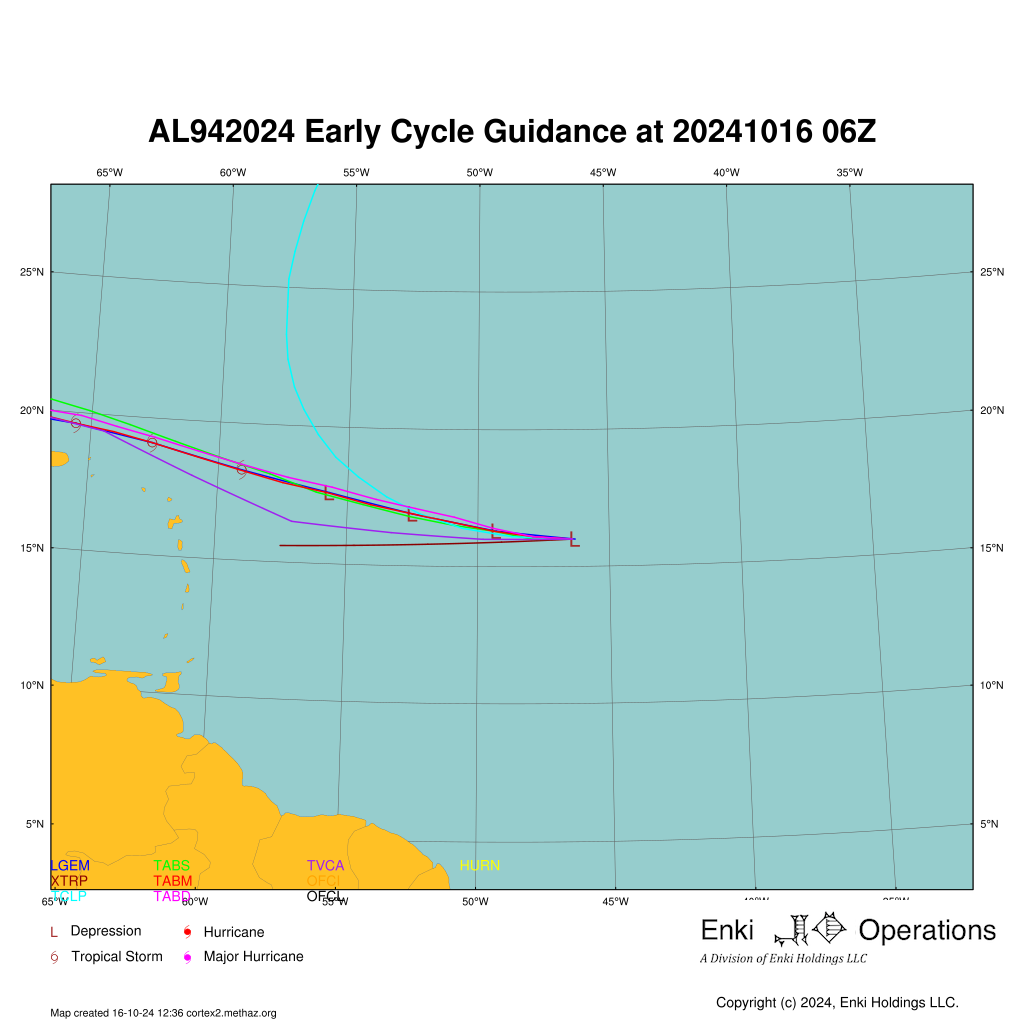
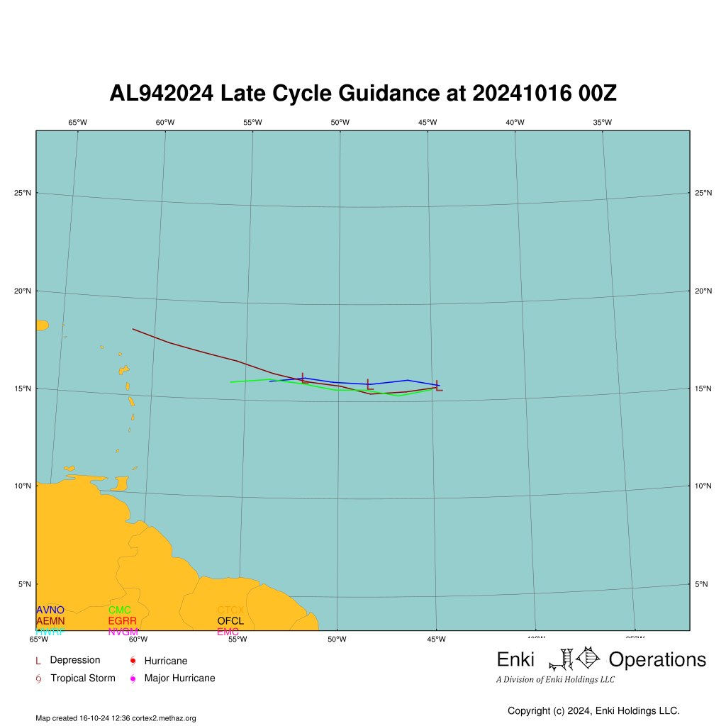
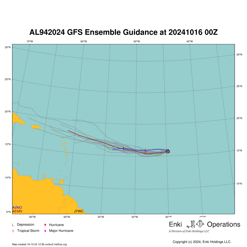
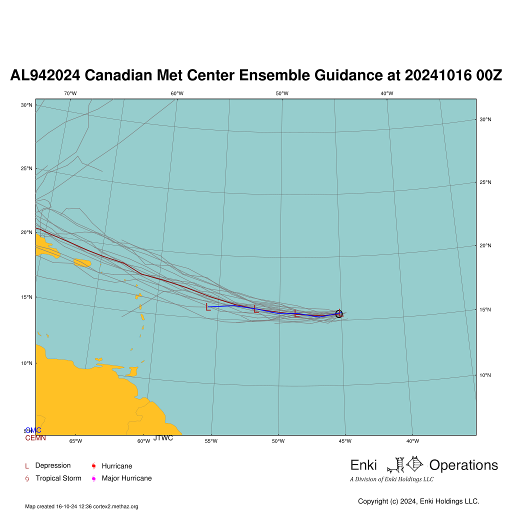
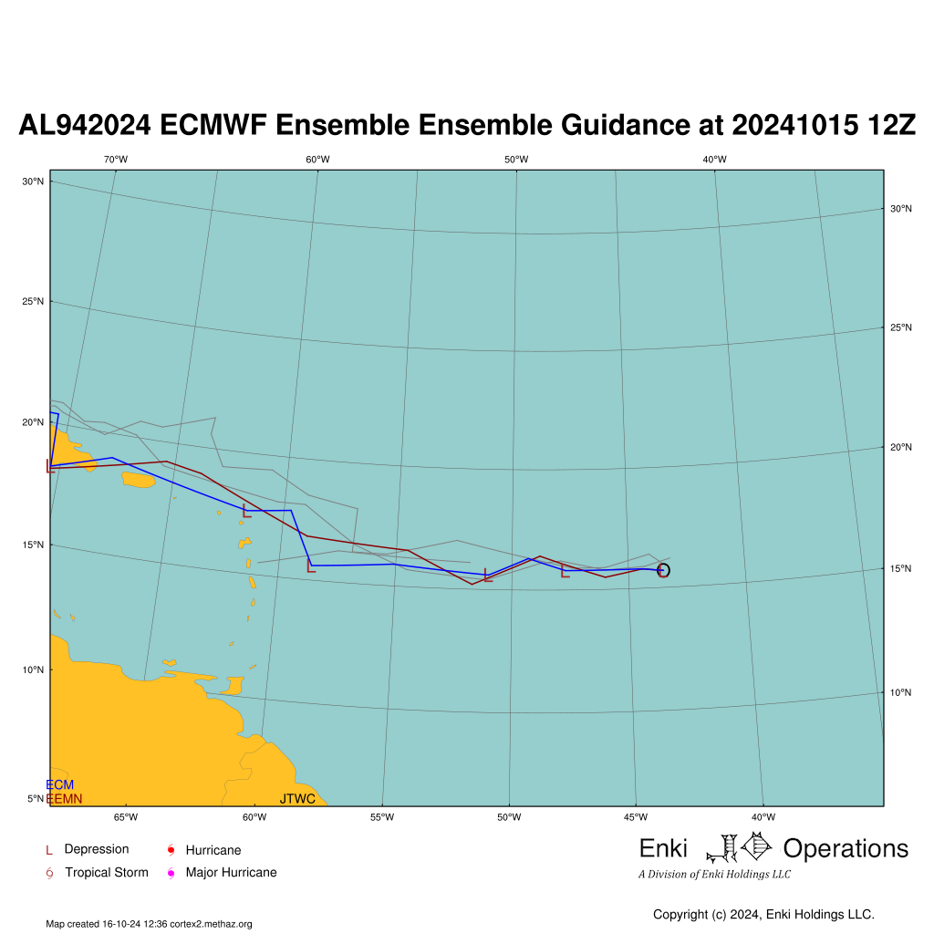
Forecast Tracks
Raw tropical cyclone models are usually called early or late. Early models are those that run in time to be included in the official forecasts.
Late models are more complex global models that take several hours to run, and the most recent run is not available for the forecaster to use in creating their products.
Up to four Ensemble Model outputs are shown (if available). The first is the US GFS model (AEMN). The second is from the Canadian Meteorological Center(CEMN). The third is the
European Center for Medium Range Forecasting model (EEMN), and the fourth the US Navy GEM model
The maps here update hourly, and are solely to give you an idea of the information and challenges facing the forecaster. The official forecast is what you should be basing your decisions on!
Model Performance Summary
tech
err012
err024
err048
err072
err096
err120
trend
AEMN
47
59
84
122
149
150
INCREASING
AVNO
45
54
69
121
164
202
INCREASING
CEMN
33
40
45
59
77
63
CONSTANT
CLP5
42
77
202
338
455
502
CONSTANT
CMC
35
41
55
64
85
124
INCREASING
HMON
44
57
78
102
108
117
INCREASING
HWRF
46
65
92
119
143
204
INCREASING
NVGM
39
57
83
115
143
96
INCREASING
TABD
41
78
179
314
470
558
INCREASING
TABM
36
55
137
247
367
455
INCREASING
TABS
34
37
64
112
182
267
INCREASING
TVCE
30
34
52
66
72
81
INCREASING
TVCN
31
35
52
70
83
127
INCREASING
XTRP
49
87
227
409
575
687
INCREASING
(14 rows)
Notes:
Average error in nautical miles for this storm as of latest forecast model run. -1 means unavailable. Intensity Forecast Report generated by cortex2.methaz.org at Wed 16 Oct 2024 11:07:23 UTC
Copyright(c) 2024 Enki Holdings, LLC. All Rights Reserved.